What the Best Places in America Have in Common
And what they reveal about alleviating poverty across the country
When President Lyndon B. Johnson declared an “unconditional war on poverty” in 1964, the nation didn’t have any method of counting the poor, or even a firm notion of how poverty should be defined. His administration scrambled to come up with a measure to chart progress. The gauge, it was later decided, would be the minimum income needed for a family of three or more to put food on the table multiplied by three (at the time, food constituted a third of the typical family budget).
Income is one vital indicator of well-being, but it is not the only one: Things like health outcomes and social mobility matter too. That’s why we should shift our focus from poverty to disadvantage. Disadvantage is a more useful term than poverty because we aren’t just talking about income—we’re trying to capture the complexity of a person’s life chances being hindered by multiple circumstances. Disadvantage is more accurate because it implies an injustice. People are being held back—unfairly.
Disadvantage cannot be understood at the individual or family level alone. Thanks to social-science research, we now know that children’s life chances are profoundly affected by their context—not only income and family circumstances but also their community—more so than by their genetic profile or the medical care they receive.
With this in mind, we created what we call the Index of Deep Disadvantage, which reflects two traditional measures of income (the poverty rate and the “deep poverty rate,” meaning those with incomes below half the poverty line), two markers of health (birth weight and life expectancy), and the rate of social mobility for children who grow up in low-income families. We used this index to rank the roughly 3,100 counties in the United States along with the 500 most populous cities.
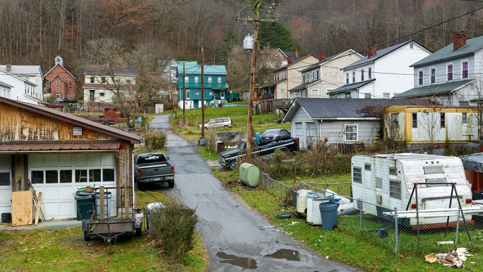
Immediately, the rankings revealed a stark geographical pattern. The first surprise—especially for professors who have spent our careers studying urban poverty—was that the most disadvantaged places on our index were primarily rural. But they didn’t fit the stereotypical image of rural America. Though some of these were majority white, most were majority Black or Hispanic. We could see, too, that many places with large Native American populations ranked among the most disadvantaged in the nation. Considerable poverty exists in Chicago, Los Angeles, and New York. But in our apples-to-apples comparison, none of those cities ranked among even the 600 most disadvantaged places in the nation. The only cities on that list were a relatively small number of industrial municipalities such as Cleveland, Detroit, and Rochester.
Some might say we should have taken into account the high cost of living in many cities, but this is more complicated than it appears. Although people pay more for housing in some places, they also benefit from good health-care systems, a more generous safety net, public transportation, and higher-quality schools. Those living in the 200 most disadvantaged places on our index were just as likely to have major difficulties paying for housing as those in America’s 500 largest cities.
The places that our index identified as the 200 most disadvantaged are concentrated in three regions—Appalachia, South Texas, and the southern Cotton Belt. (Not one county in the West, apart from those with disproportionately large Native American communities, showed up on the list.) These places share a history of intensive resource extraction and human exploitation not seen to the same degree elsewhere in the United States. In each place, this economic pattern emerged (or, in the case of the Cotton Belt, fully flourished) in the late 19th or early 20th century. In each place, one industry came to dominate the economy, a pattern that held, broadly, until the 1960s, when King Cotton, King Tobacco, King Coal, and South Texas agriculture, would bow to the twin forces of automation and global competition.
We would have had to be exceedingly dull or stubborn to have missed the fact that these places resembled, well, colonies—internal colonies within the U.S. Using terminology such as nation within a nation or colony to describe the exploitation of communities of color within the United States has a long history among Black scholars and activists. While visiting many of the nation’s most disadvantaged places, we set out to build on this work through historical research, ethnographic observations, and in-depth interviews.
In central Appalachia, we drove through the remnants of company towns, many only one or two streets wide, and the hollows—narrow valleys that can stretch for miles between the mountains. We came to Clay County, Kentucky, which before the Civil War was home to both mighty salt barons and a tapestry of subsistence farms. Big Timber and Big Coal took over after the Civil War. Today, the opioid crisis is ravaging the region. Locals in Manchester, the county seat, lament the decline of the movie theater—now a Pentecostal church—and the loss of the bowling alley; numerous bars, cafés, and beauty salons; and a park that has been plowed over for a highway-construction project. People blame the rise of opioid use on the fact that there is now “nothing to do but drugs.”
In South Texas, spinach and onion fields were once so enormous that they met the sky’s vanishing point in almost every direction, yielding fabulous profits for those who owned the land. Yet the landless laborers who planted and harvested those crops faced unimaginable hardship. For generations, the appearance of towns in South Texas followed a pattern of social hierarchy: sturdy wood-frame houses, paved streets, and enclosed sewers in the white neighborhoods; shacks, dirt roads, and privies in the Mexican parts of town. Forced to migrate to find work during the off-season, generations of Mexican American children lost their right to a decent education. Even today, adult-illiteracy rates in these places are among the highest in the nation.
When we hit the outskirts of the typical Cotton Belt town, fields gave way to a string of gleaming white antebellum homes with large lawns, old-growth trees, and grand entrances framed by columns reaching two or three stories high. These places seem serene on their face, yet in Leflore County, Mississippi, for example, Black residents told us that violence was the No. 1 problem they face. The rate of death due to interpersonal violence there was nearly four times the national average, and well above that of Cook County, Illinois, home to Chicago. As we would soon learn, Leflore County and the larger region it represents—the sprawling Cotton Belt stretching from the Carolinas to eastern Arkansas and Louisiana—are indeed among the most dangerous in the nation. These places have a long tradition of violence, both accepted and sponsored by government. For generations it was the greatest tool at the disposal of the white elite to oppress Black Americans into labor.
Throughout these regions, we saw the same themes emerge again and again—unequal schooling, the collapse of social infrastructure, violence, entrenched public corruption, and structural racism embedded in government programs.
Exploring the other end of our Index of Deep Disadvantage—the places identified as those of greatest advantage—was also vital to our research. Once again, we were surprised by where the index took us. It was not Manhattan or tech-rich Seattle. Instead, the list pointed us to the upper Midwest: Minnesota, the Dakotas, Wisconsin, Nebraska, and Iowa. Overall, poverty rates in these places are very low, babies are born healthy, people live to a ripe old age, and a low-income child usually has a similar chance of making it into the middle class as any other kid.
Counties that rank among those of greatest advantage began as agricultural communities with modestly sized farms, many originally secured through the 1862 Homestead Act that made landownership widely available. Many of these places have built on this history of broad-based wealth by making significant investments in schools, which has contributed to high graduation and college enrollment rates over generations. Using the best data available, we found that they have enjoyed the lowest rates of violent crime, income inequality, and public corruption in the nation. These counties are unusually rich in social capital: Residents are connected to one another through volunteerism, membership in civic organizations, and participation in other community activities.
These places are not without their challenges. Local job opportunities for young college graduates are sometimes limited. Yet these communities have been more successful than most in preventing poverty, promoting health, and ensuring a level playing field for their children.
One cannot fully understand the benefits enjoyed in America’s most advantaged places without considering the historic (and ongoing) exploitation of migrant labor that has gone on in them, mostly drawn from the U.S. border regions. What’s more, many of these most advantaged places neighbor Native nations, places that often rank among the least advantaged. The histories of these places are deeply and irrevocably intertwined. We visited the Crow Creek reservation in Buffalo County, South Dakota, which ranks as the fourth most disadvantaged place on our index. In 1863, its population was exiled from the rich land of southwestern Minnesota after the bloody U.S.–Dakota War. Native Americans also lost their lives by the hundreds, some in the war but most to starvation after they were forcibly relocated onto land mostly inhospitable to human habitation.
The upper Midwest is also overwhelmingly white. When we examined the relationship between whiteness and rank on the index, we found that a higher percentage of white residents is a significant predictor of a place’s rank, which is not at all surprising when one considers that the good schools and the good jobs have long been bestowed liberally on whites while being denied to Hispanic and Black Americans.
But race is not as predictive as the level of inequality, the unemployment rate, or the degree of educational attainment. Furthermore, many places that are disproportionately white, in states such as Ohio, Maine, Illinois, Indiana, Montana, Michigan, and Idaho, do not rank even among the top half of advantaged places in America. What makes the communities that are most advantaged unique is their histories as places of broad-based wealth. How different would conditions be in other parts of the country had they followed a similar, equitable course?
The lesson is that people seem to thrive—not always in high salaries but in health and life chances—when inequality is low; when landownership is widespread; when social connection is high; and when corruption and violence are rare. The social leveling that is characteristic of communities in the upper Midwest is more than just a quaint cultural feature. It is the foundation of a community’s well-being. Until these regions’ virtues are shared nationwide, poverty and disadvantage will continue to haunt America.
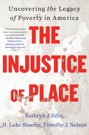
This article is adapted from the forthcoming book The Injustice of Place: Uncovering the Legacy of Poverty in America.